This scale provides detail for the really committed navigator and map enthusiast. Studying the country down to its every wall and ditch gives real confidence in route finding and satisfaction in "reading" the landscape.
To cover the Cleveland Way and the Tabular Hill link between the coast and Helmsley using Explorer maps, you'll need OL26, OL27 and 301
| |
|
These maps are available in two editions:
Paper - they fold well, and are backed with a reasonably durable laminated cover. They will remain intact, depending on how much wind and rain you have encountered!
Lam-Fold - extra strong lamination with a 'china-graph' write-on, wipe-off surface they are also tear resistant and waterproof. They are however, a little bulkier than the paper version.
|
|
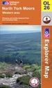
Map OL26: North York Moors. Western Area
|
click to enlarge
|
1:25,000; 2.5 inches to 1 mile; 4cm to 1km
Dimensions: 225 mm x 135 mm
|

|
|
|
|
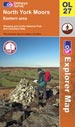
Map OL27: North York Moors. Eastern Area
|
click to enlarge
|
1:25,000; 2.5 inches to 1 mile; 4cm to 1km
Dimensions: 225 mm x 135 mm
|
|
|
|
|
|
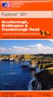
Map 301:
|
click to enlarge
|
1:25,000; 2.5 inches to 1 mile; 4cm to 1km
Dimensions: 225 mm x 135 mm
|
|
|
|
|
|
|
| |
Ordnance Survey Landranger Maps

|
|
Scale 1:50,000; 2cm to 1km; 1� inches to 1 mile
If you use the 1:50,000 Ordnance Survey Landranger maps you will need Sheets 93, 94, 99, 100 and 101; these cover the Cleveland Way and the Tabular Hill link between the coast and Helmsley.
1;50,000 is a good practical scale. The Cleveland Way is marked and the detail is sufficient for most situations along this walk. This scale allows you a wide perspective, too, and this is especially useful for the many and varied viewpoints this walk offers.
|
| |
|
These maps are available in two editions:
Paper - they fold well, and are backed with a reasonably durable laminated cover. They will remain intact, depending on how much wind and rain you have encountered!
Lam-Fold - extra strong lamination with a 'china-graph' write-on, wipe-off surface they are also tear resistant and waterproof. They are however, a little bulkier than the paper version.
|
|
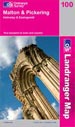
Map 100: Malton & Pickering. Helmsley & Easingwold
|
click to enlarge
|
1:50,000; 2cm to 1km; 1.25 inches to 1 mile
Dimensions: 225 mm x 135 mm
|
|
|
|
|
|
Map 99: Northallerton & Ripon
|
click to enlarge
|
1:50,000; 2cm to 1km; 1.25 inches to 1 mile
Dimensions: 225 mm x 135 mm
|
|
|
|
|
|
Map 93: Middlesbrough
|
click to enlarge
|
1:50,000; 2cm to 1km; 1.25 inches to 1 mile
Dimensions: 225 mm x 135 mm
|
|
|
|
|
|
Map 94: Whitby & Esk Dale
|
click to enlarge
|
1:50,000; 2cm to 1km; 1.25 inches to 1 mile
Dimensions: 225 mm x 135 mm
|
|
|
|
|
|
Map 101: Scarborough
|
click to enlarge
|
1:50,000; 2cm to 1km; 1.25 inches to 1 mile
Dimensions: 225 mm x 135 mm
|
|
|
|
|
| |
 Harvey Maps
|
|
This specially designed strip map, covering the entire route is the latest offering from Harvey Maps.
The route is clearly marked in a large scale innovative style which also conveys information as to whether the trail follows track, path, bridleway or road along particular sections.
These maps are an acquired taste. Undoubtedly, they are clear and reduce painful decision-making. But, the land for only a short distance on either side of the route is shown you may find that this will take away some of your enjoyment of the landscape; you can't use them to give yourself the broader picture, lining up the hilltops around you, for example. They do however, provide essential supplementary information to assist you in planning your walk.
This map is only available in a waterproof edition which has a wax/silicon coasting. The maps fold well into the plastic case with which they are provided but they are not tear resistant.
|
| |
|
Cleveland Way map
|
click to enlarge
|
1:40,000; 2.5cm to 1km
Dimensions: 240 mm x 120 mm.
|
Harvey Map
|
|
Edition |
Weight |
Price |
|
|
Harvey Map |
100 gms |
�12.95 |
 |
|
|
|
|
|
|
|
|
| |


 Find us on Facebook